Individual Placement Spotlight Series: Hannah Pfeffer

By Jesse Wolk, Utility Mapping Specialist Individual Placement / AmeriCorps Member placed at Minnesota Department of Natural Resources, Division of Parks and Trails
IV: The Office
The Individual Placement (IP) Spotlight Blog is a series of interviews between Jesse Wolk and his fellow IP members with the goal of highlighting their unique positions, projects, and backgrounds while reflecting on their service term in the context of the Natural Resources career field. In the fourth edition of the series, The Office, the spotlight is shifted to our Archival Mapping Specialist– Hannah Pfeffer!
There is a maxim frequently said in Natural Resources, “Enjoy your field work while it lasts, because eventually, you’ll end up in front of a computer.” I heard this a lot since I graduated in 2022 and I happily scoffed, “I joined this career field to be outside. Not to work in a cubicle.” Unfortunately for those scoffers, if the ladder of Natural Resources careers is climbed long enough, an office is reached. From biologists to geologists, the more money you get paid, the more time you spend in the least natural setting imaginable: an office. This has especially become true over the last thirty years with the acceptance of technology by the conservation community. There is one branch of software applications that are most emblematic of this shift. Natural Resource professionals, on all levels, are now expected to know how to use Esri’s mapping programs, the best of which is ArcGIS Pro.
Esri’s mapping software revolutionized the work for land management organizations. With the advancement of ArcGIS, and its predecessors, more work can be done in less time. From data collection to analysis to map making, with Esri’s suite of Geographic Information Systems (GIS), it can all be done in one place. It is ubiquitous across many different careers. Recreation managers can use topographic features to design a trail that switchbacks over a bluff in the Driftless area and biologists can easily digitize sites of interest and record results for vegetation surveys. The result is an accurate map that, hopefully, conveys a clear message. The software can be difficult to learn, and it can often be time-consuming, but it has transformed the work-modality for many management-level resource professionals. There is less need to go out in the field if the information can be accessed right from their desk. Admittedly, there is no denying that some joy may have been lost from this progression. On the other hand, projects are way more efficient, accurate, and cost-effective thus making room for more land and species to be managed and protected.

Minnesota’s Department of Natural Resources has quite a few people dedicated to helping their staff throughout the state navigate ArcGIS. They also have a few staff that specialize in making maps for the public. The most common of these maps are for people recreating in the state’s parks, trails, water trails, or forests. Enter Individual Placement (IP) member Hannah Pfeffer. Hannah serves under the direction of a DNR employee dedicated to making recreational maps for the state’s lands that are accessible, easy, and functional. Essentially, Hannah is working with a cartographer.
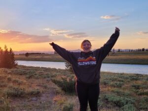
Hannah grew up in small central Minnesota town, Avon, which, as she notes, is a trailhead for one of the trails that her boss makes maps of, the Lake Wobegon trail. Her interest in land management and conservation got sparked throughout the six of her family’s national park trips. Hannah went on the classic road trips that many Midwesterners embark on and got interested in the biodiversity of the United States. Hannah took this curiosity to her college where she started taking classes that fueled that interest. She says that she, “took a bunch of random classes” but to me, it sounds like she was just following her passion. At the University of Minnesota – Twin Cities, she settled on Geography, where she combined hard sciences with social sciences and studied the landscape without having to take the dreaded Organic chemistry. After she graduated in the Fall of 2022, Hannah hit some walls finding positions that fit her interest. At one of her university’s job fairs, she met the IP Program Manager and felt that the Mapping Specialist position would allow her to build skills to kickstart her career.
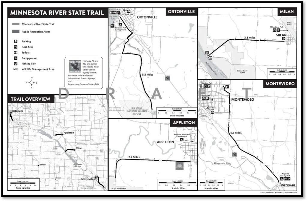
When Hannah graduated, she reflected that she, “loved getting her degree but felt like (she) couldn’t do anything (with it).” Currently, as the Mapping Specialist, she really feels like that sentiment is changing. Hannah has gotten four months of training on Adobe Illustrator, Avenza Maps, and ArcGIS Pro to prepare her for her current position and for future ones. This helped her build a map for the Minnesota River State Trail where she did everything in the process from collecting data to constructing the map itself. She has also helped with making maps more visually accessible and is also conducting data quality control on maps for all the state parks to make sure that they are accurate. It appears that she has found a use for her degree.

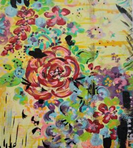
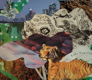
The biggest challenge she has found so far is something with which I resonate. The deeper you get into ArcGIS Pro, the faster you approach coding and database management. Hannah was initially daunted by learning how to code but found an easy way to justify diving-in. In Hannah’s free time, she is an artist. She enjoys engaging her creative side through painting, crocheting, and embroidery all of which she likes to do in an abstract style. This does connect back to my point but let’s take a break and check out some of it out below!

“I made a lot of art during COVID as I had so much time and feels inside me. I’ve always experimented with florals, but this is the first painting that incorporated my love of bold colors and delicate florals elements that made me happy.” – Hannah Pfeffer

“This was created at the MIA “Art in the Parks” summer series. Artist, Keegan Xavi, lead the event and opened the world of collage art to me. I loved the juxtaposition of the natural elements in the foreground with city skyline in the background of this piece.” – Hannah Pfeffer
Hannah’s art experience has coached her on how to handle her coding struggle. As she told me, “If you want to get good at a certain style of art, you have to get good at the essentials.” In this case, her art is cartography and the essentials are coding languages like Python, SQL, and HTML. She is using the IP program to facilitate this through its professional development budget offered to all its members throughout their service term.
Essentially, Hannah has found a way to view her work as art. Which it is. As a result of the accessibility of GIS software, Cartography may be more influenced by aesthetics than ever before and it uniquely blurs the divide between Art and Science. Hannah recognizes this and has found her work to be tedious but, surprisingly, fun. Even though she works solo from her well-decorated home or in a bleak office, she still has found a way to consistently engage her creative side. Hannah plans to continue down her current path by serving another term as a Mapping Specialist to continue building her skills and then hopes to work for a smaller agency as a planner or mapper.
Escaping the Natural-Resource-march towards stability and salary, which most often comes in the form of a desk job, may be impossible. However, it doesn’t mean that dissatisfaction must come with it. For many young field technicians out there, who sneer at the desk-jockeys, just know that your time may one day come. If it does, keep an open mind, you just may just find creativity and happiness.
Thanks for reading and catch you in a few weeks!
– Jesse Wolk