The Legacy of Lake Agassiz
By Kyle Dahlquist, Clean Water Corpsmember / AmeriCorps Member placed at Pennington SWCD
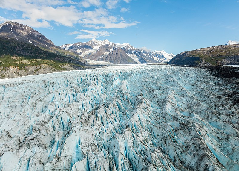
Minnesota has always been defined by its lakes. It contains more fresh water than any other contiguous U.S. state, and more coastline than California, Hawaii, and Florida combined. The state’s identity is intrinsically connected to fresh water, and we owe this wealth of resource to the glaciers that once enveloped much of North America. But before the Great Lakes of Superior, Michigan, Huron, Ontario, and Erie became the signature icons of the upper Midwest, a far larger lake dominated the region.
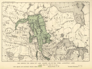
During the Pleistocene Epoch (a fancy term for the Ice Age), much of North America was subject to repeated glaciations over a period of roughly 2 million years. As the ice retreated for the last time, around 10,000-12,000 thousand years ago, an ice dam was formed. The remains of the Laurentide Ice Sheet obstructed the drainage of the continent northward into the Hudson Bay, forming a massive reserve of meltwater called Lake Agassiz (a-guh-see). First hypothesized in 1823, the lake was officially named in 1879 after the Swiss-born geologist Louis Agassiz, who is considered the founder of glaciology.
At its apex, the extent of Agassiz was nothing short of breathtaking. It spanned 170,000 square miles (or 440,00 square kilometers), making it larger than any modern lake, including the Caspian Sea, the largest inland body of water in the world. Its area surpassed all of our modern Great Lakes, combined. In fact, many of the major lakes in northern Minnesota and southern Manitoba are direct remnants of Lake Agassiz, including Lake of the Woods, Red Lake (upper and lower), Lake Winnipeg, Lake Manitoba, and Lake Winnipegosis. Further evidence of Agassiz’s impact can be found in the fertile silt-like soil of the Red River Valley, a parting gift as the lake emptied for the final time.
Lake Agassiz’s draining had significant effects on Earth’s oceans, early human activity, and even the climate. Global sea levels rose an estimated 2.6-9.2 feet (0.8-2.8 meters)! The massive influx of meltwater disrupted ocean currents. This is theorized to have contributed to the 8,200-year climate event, when Earth’s temperature suddenly cooled by an estimated 3.3 degrees Celsius in only 20 years. Agassiz’s sister glacial lake, Lake Ojibway, also drained into the Hudson Bay. Some historians credit this momentous event with influencing early agricultural expansion in Europe.
Despite being gone for over 8,000 years, Lake Agassiz’s influence is still felt in northern Minnesota. And who knows? Some day we may even see the triumphant return of this ancient giant.